

Canal Maps
1) CAPE CORAL CANAL INFORMATION:
Cape Coral canals consist of both freshwater and saltwater canals. However Freshwater does not have access to the Gulf. Gulf Access includes sailboat access (unrestricted canals), direct access (no locks or lifts but may be multiple bridges) and partially restricted (may be behind a lock or lift). Most canals have access to the Gulf via the Caloosahatchee River (SW/SE) or the Matlacha Pass in the NW section of the Cape.
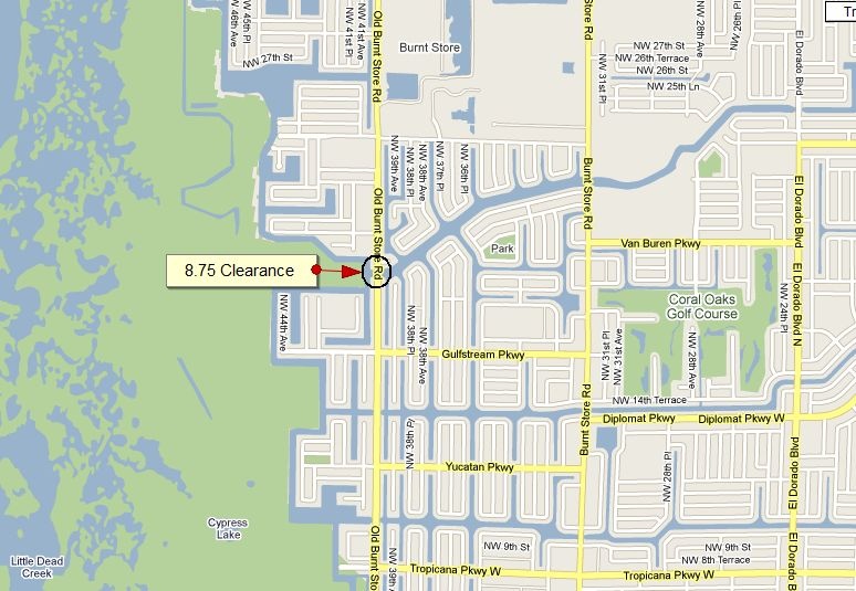
Northwest Cape bridges:
The bridge pictured below is gulf access, North of Tropicana,
intersecting Old Burnt Store Rd.
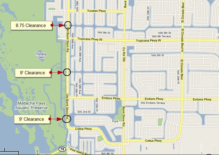
The three bridges pictured below are gulf access and located just North of Pine Island Road
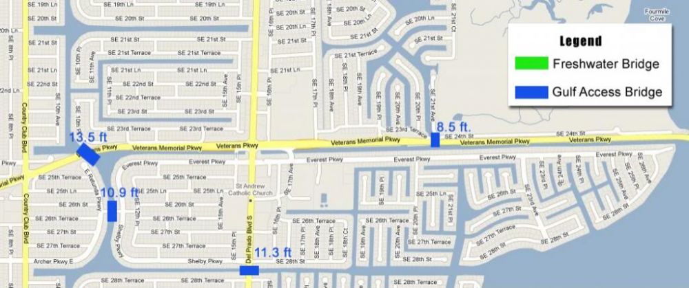
Southeast Cape Freshwater and Gulf Access Bridges:
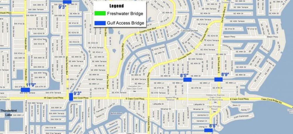
Southwest Cape Freshwater and Gulf Access Bridges:

West Cape Gulf Access Bridges (Cape Harbor Area):
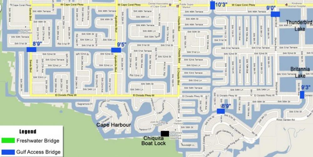
Chiquita Boat Lock
Boat Locks conveniently allow the boater to keep their vessel in the water while changing water levels. The Chiquita Lock, also referred to as the Spreader Canal Lock, is located between Cape Coral Parkway and Veterans Highway in Southwest Cape Coral. By boat, it is approximately 2.75 status miles from the Sanibel Causeway Bridge. It is the area's main and largest lock, providing gulf access into the ICW via the Caloosahatchee River.
The Chiquita Lock leads to the Spreader Canal systme, protected wetlands, and many of the area's most desireable waterfront homes.
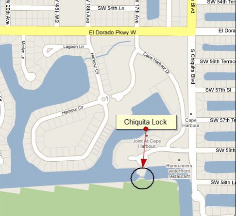
The Chiquita Lock is manned from 6 am-10 pm
It can accommodate boats up to 19' x 80'.
After hours: Call the lock operator 1/2 hour prior to arrival.
Phone: 239-542-5661
2) Fort Myers Beach Maps and Links:
https://www.google.com/maps/@26.4945547,-81.9412252,17z